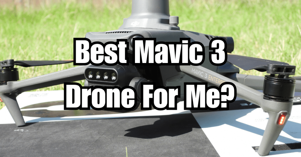
The DJI Mavic 3 series stands as a pinnacle of innovation tailored for a variety of professional applications. From high-resolution imaging to advanced sensing technologies, each model is designed to excel in specific fields. Whether you’re conducting detailed aerial surveys, needing thermal imaging for emergency responses, or monitoring agricultural health, understanding the capabilities of each Mavic 3 drone—Enterprise, Thermal, and Multispectral—is essential. This guide will delve into the features, applications, and practical considerations of each to help you decide which Mavic 3 drone is best suited for your professional needs.
Key Takeaways
- Choosing the Right Mavic 3 Drone: Each Mavic 3 model—Enterprise, Thermal, and Multispectral—is designed for specific applications, such as urban inspections, emergency services, and agricultural monitoring, making it crucial to select based on your operational needs.
- Technical Specifications and Features: The Mavic 3 Enterprise offers a dual camera with 20MP resolution and hybrid zoom, ideal for detailed inspections from a distance; the Mavic 3 Thermal includes a thermal camera for heat detection crucial in firefighting and rescue; the Mavic 3 Multispectral is equipped with multispectral cameras for agricultural and environmental data analysis.
- Practical Considerations for Buyers: Consider factors such as battery life, image transmission quality, and the drone’s ability to navigate and avoid obstacles when selecting a drone to ensure it meets both budgetary and operational requirements.
- Operational Efficiency and Applications: Each drone model enhances productivity in its field—Enterprise for infrastructure, Thermal for emergency scenarios, and Multispectral for environmental and agricultural uses—highlighting the importance of matching the drone to the task for maximum efficiency.
- Support and Services: Utilize the comprehensive support and training offered by manufacturers like DJI to maximize the operational capabilities of the Mavic 3 drones, ensuring a good return on investment through effective use and maintenance.
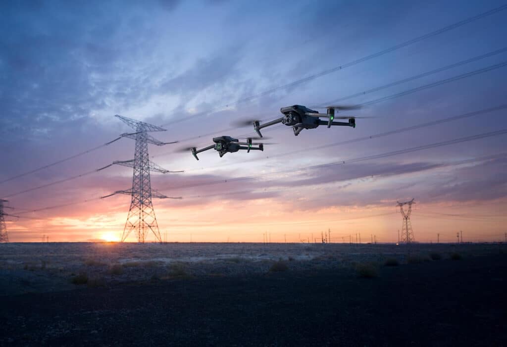
Exploring the Mavic 3 Drone Models
DJI Mavic 3 Enterprise
The DJI Mavic 3 Enterprise is designed for versatility and precision in commercial drone operations. Equipped with a dual-camera setup, it features a wide 4/3 CMOS 20MP sensor with a mechanical shutter to capture high-resolution images quickly, minimizing motion blur in dynamic environments. The telephoto camera, with a 162mm equivalent focal length and 12MP resolution, offers up to 56× hybrid zoom, allowing detailed inspections from a safe distance. This model is ideal for infrastructure inspections, search and rescue missions, and large-scale surveying due to its robust imaging capabilities and extended flight time of 45 minutes.
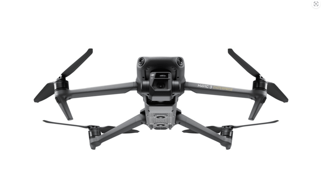
DJI Mavic 3 Thermal
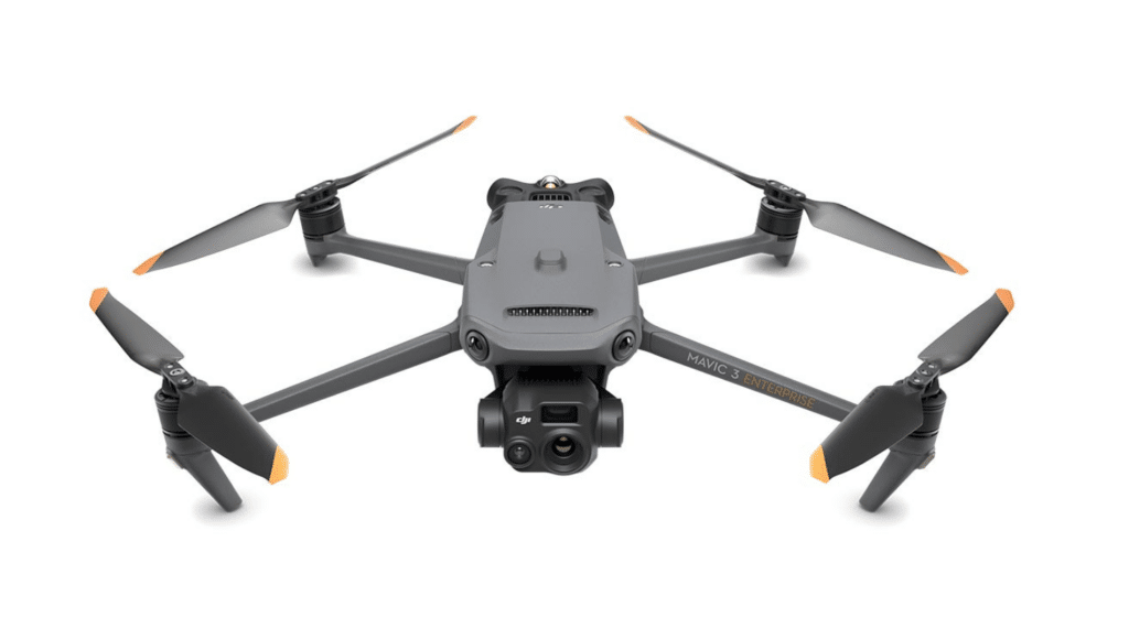
The DJI Mavic 3 Thermal is tailored for emergency responders and environmental scientists who require detailed thermal imaging. It combines a 48MP camera with a 24mm equivalent focal length for wide shots and a 12MP zoom camera (162mm equivalent) for detailed captures. The thermal camera, with a 61° DFOV and 40mm equivalent focal length, provides a resolution of 640 × 512, enabling operators to detect heat signatures day or night, making it indispensable for firefighting, wildlife monitoring, and electrical inspections. The integration of omnidirectional sensors ensures safe operation in complex environments, enhancing the drone’s utility in critical situations.
DJI Mavic 3 Multispectral
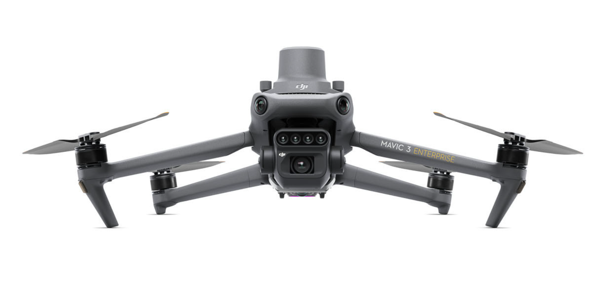
The DJI Mavic 3 Multispectral is a game-changer in agricultural and environmental monitoring. It features a newly upgraded, highly integrated imaging system with a 20MP RGB camera and four 5MP multispectral cameras that capture green, red, red edge, and near-infrared wavelengths. These capabilities allow for detailed analysis of crop health and environmental changes over time. The inclusion of a sunlight sensor aids in light compensation, providing consistent, accurate NDVI data crucial for precision farming. With RTK module support for centimeter-level positioning, this drone eliminates the need for ground control points in high-precision aerial surveying, significantly enhancing efficiency in data collection.
Shared Features Across Models
All three models boast advanced features that enhance their utility in professional applications. They offer up to 45 minutes of flight time per charge, covering up to 2 square kilometers, which is vital for extensive surveying missions. The 100W charging hub and 88W direct drone charging capability ensure quick turnaround between flights. The next-generation Quad-antenna O3 Enterprise Transmission provides stable, reliable connections even in challenging environments, while omnidirectional sensing and APAS 5.0 system offer enhanced navigational safety, automatically rerouting around obstacles. This comprehensive suite of features makes the Mavic 3 series exceptionally well-suited for a wide range of industrial applications, ensuring efficiency, safety, and high-quality data capture.
Technical Specifications Comparison
In this section, we delve into the technical specifications of each Mavic 3 model to highlight their distinctions and how these contribute to their specialized applications. Understanding these technical details is crucial for choosing the drone that best fits your professional needs.
Camera Capabilities
- Wide Camera: 4/3 CMOS, 20MP with mechanical shutter ensures rapid capture with minimal blur, making it ideal for dynamic and fast-paced environments.
- Telephoto Camera: Provides a 162mm equivalent focal length with 12MP resolution, enabling detailed imaging at extended ranges with 56× hybrid zoom.
- Wide Camera: 48MP sensor with a 24mm equivalent focal length captures extensive detail over broad areas, perfect for environmental mapping and large scene investigation.
- Zoom Camera: Mirrors the Enterprise’s telephoto specs for precision at a distance.
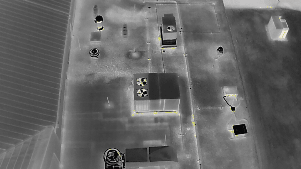
- Thermal Camera: 640 × 512 resolution with a 61° diagonal field of view, captures heat variations effectively, crucial for emergency and nocturnal operations.
- RGB Camera: 20MP 4/3 CMOS sensor paired with a fast mechanical shutter (1/2000s) to capture crisp, clear images.
- Multispectral Cameras: Four 5MP cameras covering green, red, red edge, and near-infrared spectra, essential for detailed vegetation analysis and environmental monitoring.
Battery Life and Charging
All three models are designed with endurance in mind, featuring batteries that allow for a maximum flight time of 45 minutes. This capability is essential for covering large areas without the need for frequent landings, which is particularly beneficial for extensive agricultural surveys and prolonged inspection tasks.
- Charging Options: Both the drones and their batteries can be rapidly recharged using a 100W charging hub, or directly via an 88W fast charger, minimizing downtime and enhancing field efficiency.
Image Transmission and Sensing Technology
Next-Generation Image Transmission
- O3 Enterprise Transmission: Equipped with a quad-antenna system, it ensures a stable and reliable connection even in diverse and challenging environments, which is vital for maintaining control and data quality during critical missions.
Omnidirectional Sensing
- Advanced Sensing: Each model comes with omnidirectional obstacle sensing that includes wide-angle lenses on all sides, ensuring complete spatial awareness and safety during flight. The drones are capable of adjusting proximity alarms and braking distances according to mission specifics, which is critical for navigating complex spaces.
- Advanced Return-to-Home (RTH): This feature automatically calculates the optimal path back to the launch point, conserving battery life and reducing the risk of accidents.
- APAS 5.0: The latest version of the Advanced Pilot Assistance Systems allows for smoother navigation around obstacles, providing peace of mind during autonomous operations.
Through these comprehensive specifications, each Mavic 3 model is tailored to meet specific professional demands, offering powerful tools for a variety of applications. Whether it’s high-resolution imaging, thermal detection, or multispectral analysis, understanding these technical nuances will guide users in selecting the right drone to maximize their operational effectiveness and return on investment.

| Feature | Mavic 3 Enterprise | Mavic 3 Thermal | Mavic 3 Multispectral |
|---|---|---|---|
| Camera System | – Wide: 4/3 CMOS, 20MP, Mechanical Shutter – Tele: 162mm, 12MP, 56× Hybrid Zoom | – Wide: 24mm, 48MP – Zoom: 162mm, 12MP, 56× Hybrid Zoom – Thermal: 40mm, 640 × 512, DFOV 61° | – RGB: 4/3 CMOS, 20MP – Multispectral: Green (560 nm), Red (650 nm), Red Edge (730 nm), Near-Infrared (860 nm), all 5MP |
| Imaging Capabilities | High-resolution imaging for inspections and surveys. | Wide and zoom capabilities for detailed visual imaging plus thermal imaging for heat detection. | Integrated system for precise multispectral imaging ideal for agricultural and environmental monitoring. |
| Shutter Speed | Fastest mechanical shutter: 1/2000s | N/A | Fastest mechanical shutter: 1/2000s for RGB camera |
| High Speed Burst | 0.7s high speed burst when RGB camera is used | 0.7s high speed burst when RGB camera is used | 0.7s high speed burst when RGB camera is used |
| Sunlight Sensor | N/A | N/A | Captures solar irradiance, enhancing light compensation for more accurate NDVI results |
| Positioning | Standard GPS | Standard GPS | RTK module for centimeter-level positioning without ground control points |
| Battery Life | 45 minutes | 45 minutes | 45 minutes |
| Charging Options | – 100W charging hub – 88W direct charging | – 100W charging hub – 88W direct charging | – 100W charging hub – 88W direct charging |
| Transmission | Quad-antenna O3 Enterprise | Quad-antenna O3 Enterprise | Quad-antenna O3 Enterprise |
| Obstacle Avoidance | Omnidirectional with zero blind spots | Omnidirectional with zero blind spots | Omnidirectional with zero blind spots |
| Advanced Navigation | APAS 5.0, Advanced RTH | APAS 5.0, Advanced RTH | APAS 5.0, Advanced RTH |
Applications in Different Industries
The DJI Mavic 3 series excels not only due to its technical prowess but also through its versatility across various professional landscapes. Each model is tailored to meet specific industry needs, from urban development and emergency response to agriculture and environmental monitoring. Here, we explore how each drone model can be integrated into these fields to enhance operational efficiency and data accuracy.
Urban and Infrastructure Projects: Mavic 3 Enterprise
The Mavic 3 Enterprise is particularly well-suited for urban planning and infrastructure monitoring. Its 20MP camera with a mechanical shutter captures high-resolution images swiftly, ideal for documenting construction progress and inspecting structures for maintenance needs without disrupting the surrounding environment. The 56× hybrid zoom allows for detailed inspections of tall buildings, bridges, and other infrastructures from a safe distance, reducing the risk to inspection teams and speeding up the data collection process.
Search and Rescue, Firefighting: Mavic 3 Thermal
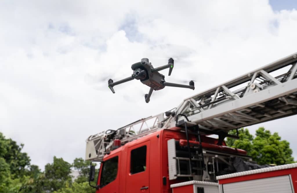
In emergency services, the Mavic 3 Thermal proves invaluable. The thermal imaging capabilities allow rescue teams to detect heat signatures in search and rescue operations, providing real-time data that can pinpoint the locations of individuals in distress, even through smoke or foliage. For firefighting, this drone can identify hotspots in a fire, helping teams make informed decisions about where to focus their efforts, enhancing safety and operational effectiveness.
Agriculture and Environmental Monitoring: Mavic 3 Multispectral
The Mavic 3 Multispectral is designed to revolutionize agriculture and environmental studies. It offers precise imaging for high-precision aerial surveying without the need for ground control points, thanks to its RTK module. The multispectral cameras collect data across different light spectra, providing detailed insights into crop health, water usage, and soil composition. This data helps farmers optimize crop yields and reduce waste, while environmental scientists can monitor changes in ecosystems over time, aiding in conservation efforts.
Practical Use Cases
- Building and Site Inspections: The Mavic 3 Enterprise captures detailed images that help in assessing the structural integrity of buildings and immediate infrastructural assessments after natural disasters.
- Thermal Mapping: The Mavic 3 Thermal is used in environmental regulations compliance, ensuring that industries meet thermal pollution standards.
- Agricultural Surveys: With the Mavic 3 Multispectral, agronomists can conduct detailed surveys to create zonal maps for soil and crop health, tailoring fertilizer use and irrigation to specific conditions in the field.
Each of these applications not only showcases the robust capabilities of the Mavic 3 series drones but also illustrates how they can be effectively used to enhance productivity and accuracy in professional settings. By leveraging these advanced tools, industries can gain significant advantages, achieving more with less time and resources while also improving safety and environmental sustainability.
| Drone Model | Key Applications | Ideal Use Cases |
|---|---|---|
| Mavic 3 Enterprise | – Urban Planning – Infrastructure Inspection – Surveillance | – Detailed inspections of buildings, bridges, and other infrastructure – Monitoring large-scale construction projects – Surveillance operations in urban settings |
| Mavic 3 Thermal | – Search and Rescue – Firefighting – Wildlife Monitoring | – Locating individuals in distress during search and rescue missions – Identifying hotspots in wildfires – Monitoring wildlife and their habitats at night |
| Mavic 3 Multispectral | – Agriculture – Environmental Monitoring | – Monitoring crop health and managing agricultural inputs efficiently – Surveying natural resources and tracking environmental changes |
Practical Considerations for Buyers
Choosing the right drone from the DJI Mavic 3 series involves understanding not only the technical specifications and industry applications but also considering practical aspects that will affect the drone’s performance and suitability for your specific needs. Here, we’ll provide essential tips and factors to consider, ensuring you select the model that best fits your operational requirements and budget constraints.
Assessing Your Needs
Before making a purchase, clearly define what you expect from a drone. Consider the following:
- Type of Data Collection: Are you focusing on visual, thermal, or multispectral data? Each Mavic 3 model serves different data acquisition needs.
- Environment of Operation: Will the drone be used indoors, in urban areas, or over rugged terrains? Obstacle avoidance and transmission capabilities should be prioritized accordingly.
- Regulatory Compliance: Ensure that the drone you choose complies with local aviation regulations, which may affect the permissible drone operations, especially in sensitive or densely populated areas.
Cost-Effectiveness
While the initial purchase price is a significant factor, consider the long-term value of your investment:
- Maintenance and Durability: Look into the durability of the drone under various environmental conditions and the availability of maintenance services or parts.
- Battery Life and Charging Efficiency: Longer battery life and fast charging capabilities mean less downtime and more productivity, crucial for large-scale or time-sensitive operations.
Operational Efficiency
Evaluate how the features of each Mavic 3 model can enhance your operational efficiency:
- Ease of Use: User-friendly interfaces, automated flight modes, and integrated software solutions can reduce training time and streamline operations.
- Scalability: If your operations might expand, consider a drone with capabilities that can grow with your needs, such as the ability to add additional sensors or software upgrades.
Comparison Shopping
- Product Reviews and User Testimonials: Research and consider feedback from current users to gauge real-world performance and reliability.
- Demonstrations and Pilot Tests: Whenever possible, see the drones in action. Many dealers offer demonstration flights to showcase the capabilities of each model, providing a practical look at what each can do.
Support and Service
- Warranty and Customer Support: Comprehensive warranty terms and responsive customer support can mitigate potential operational disruptions.
- Training and Resources: Adequate training and accessible technical resources ensure you can maximize the drone’s capabilities and handle any issues that arise.
By carefully considering these practical aspects, prospective buyers can make informed decisions that align with their professional needs and financial plans. The right drone will not only fit your immediate requirements but also offer growth potential as your skills and business needs evolve, ensuring a worthwhile investment in the rapidly advancing field of aerial technology.
Throughout this exploration of the Mavic 3 series, we’ve highlighted the distinctive features and applications of the Mavic 3 Enterprise, Thermal, and Multispectral models. Each drone is engineered with precision to meet the demands of various industries, enhancing capabilities in imaging, data collection, and operational efficiency. If you’re considering integrating advanced drone technology into your business, visit Blue Falcon’s Drone Integration Services to discover how these tools can be seamlessly incorporated into your operations. For customized solutions, please contact us through our contact page. Equip your business with the right Mavic 3 model and elevate your operational potential to new heights.

