Transform Your Business Operations with Advanced Drone Solutions
Drone Technology Integration Services
At Blue Falcon Aerial, we specialize in leveraging the power of drone technology to revolutionize business workflows across a range of industries. With our expertise in aerial mapping, modeling, and actionable insights, we are uniquely positioned to help your business harness the full potential of advanced drone capabilities.
Our Expertise and Credentials
- Industry Leaders: We’re at the forefront of integrating drone technology, offering solutions that enhance efficiency, precision, and data-driven decision-making.
- Educators and Innovators: As instructors of aerial mapping courses and keynote speakers at prestigious industry conferences, our team brings unparalleled expertise and insight to every project.
- Tailored Solutions: We understand that each business is unique. That’s why we develop custom Standard Operating Procedures (SOPs), provide equipment recommendations, and offer comprehensive training, ensuring your team’s success.
Our Services
Detailed Needs Assessment: We begin by understanding your current operations, challenges, and goals. This initial consultation helps us identify the most impactful ways to integrate drone technology into your workflow.
Custom SOP Development: Leveraging our extensive experience, we create a tailored plan that outlines the integration of drone operations, ensuring alignment with your specific business needs.
Equipment Selection Guidance: Avoid the guesswork in selecting the right drones and sensors. We recommend the best equipment that fits your operational requirements and budget.
Professional Training and Support: Our commitment extends beyond technology implementation. We provide expert training to empower your team as proficient drone operators, ensuring long-term success.
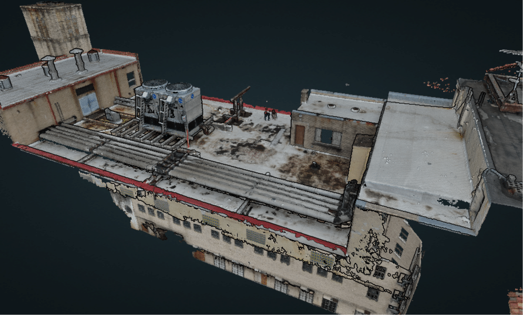
Actionable Data Insights: Transform raw data into actionable insights. Our team processes the captured information to create comprehensive reports, maps, and models that drive better business decisions.
Building Long-Term Partnerships
Your journey towards operational excellence is our priority. We aim to make your internal drone program not only self-sufficient but also a key driver of business success. Our ongoing support and expertise ensure that you continue to reap the benefits of drone technology long into the future.
Ready to Elevate Your Business with Drone Technology?
Discover how Blue Falcon Aerial can transform your operations, enhance decision-making, and unlock new opportunities for growth. Contact us today to schedule a consultation and explore a tailored drone integration strategy for your business.
Frequently Asked Questions
What exactly are drone technology integration services?
Drone technology integration services involve tailoring drone solutions to enhance your business workflows. This includes consultation, SOP development, equipment recommendations, training, and data analysis, ensuring comprehensive support from start to finish.
Who can benefit from these services?
Businesses across various industries such as construction, agriculture, real estate, and more can greatly benefit. If your operations involve data collection, mapping, or aerial surveillance, our services can enhance your efficiency and decision-making.
What makes Blue Falcon Aerial different from other providers?
Our unique blend of expertise as educators, industry innovators, and our commitment to creating a self-sufficient drone program within your organization sets us apart. We ensure that our solutions are not just about technology but about integrating this technology effectively into your existing operations.
Will we need to purchase our own drones?
Yes, part of our service includes providing a custom shopping list of drones and sensors that best suit your operational needs and budget, ensuring you invest wisely.
What if we have no experience with drones?
No worries! We offer comprehensive training and support to ensure your team becomes proficient in drone operations, emphasizing safety and efficiency.
How does the data processing work?
Our team specializes in turning raw drone data into actionable insights through advanced processing techniques. This involves creating detailed maps, models, and reports that inform your business decisions.
Is there ongoing support available?
Absolutely. Our goal is to build long-term partnerships, offering continued support for training, updates, and any additional data analysis needs, ensuring your drone program remains effective.
How do we get started with your services?
The first step is a consultation to discuss your needs, challenges, and objectives. From there, we outline a plan tailored to your business. Contact us to schedule your initial meeting.
What about privacy and legal concerns with drone usage?
We prioritize compliance with all privacy and legal regulations related to drone operations, providing guidance on laws and best practices to ensure your operations are both effective and lawful.
Is there a satisfaction guarantee?
Yes, we offer a 30-day 100% satisfaction money-back guarantee, showcasing our confidence in the value and impact of our services.
numbers
Client results
Support Functions
Lorem ipsum dolor sit amet, consectetur adipiscing elit. Ut elit tellus, luctus nec ullamcorper mattis.
Service Operations
Lorem ipsum dolor sit amet, consectetur adipiscing elit. Ut elit tellus, luctus nec ullamcorper mattis.
Supply Chain
Lorem ipsum dolor sit amet, consectetur adipiscing elit. Ut elit tellus, luctus nec ullamcorper mattis.
Learn more
Frequently Asked Questions
Aerial lidar is commonly used in the construction industry for tasks such as creating digital terrain models, measuring volumes of stockpiles and cut/fill areas, and identifying potential issues with a construction site before work begins.
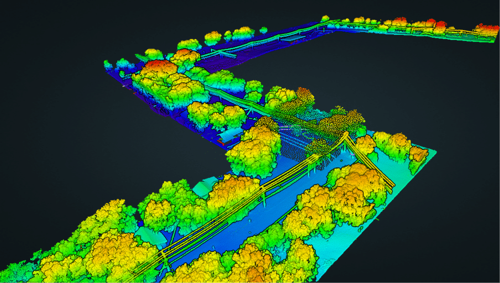
Aerial lidar (light detection and ranging) is a remote sensing method that uses laser technology to measure the distance to a target. It differs from other forms of remote sensing such as photogrammetry and radar in that it can collect high-resolution, precise 3D data in a relatively short amount of time.
Aerial lidar measurements can be extremely accurate, with typical horizontal and vertical accuracy levels of less than 10 cm. The level of accuracy is dependent on factors such as the density of the point cloud data collected and the quality of the sensor used.
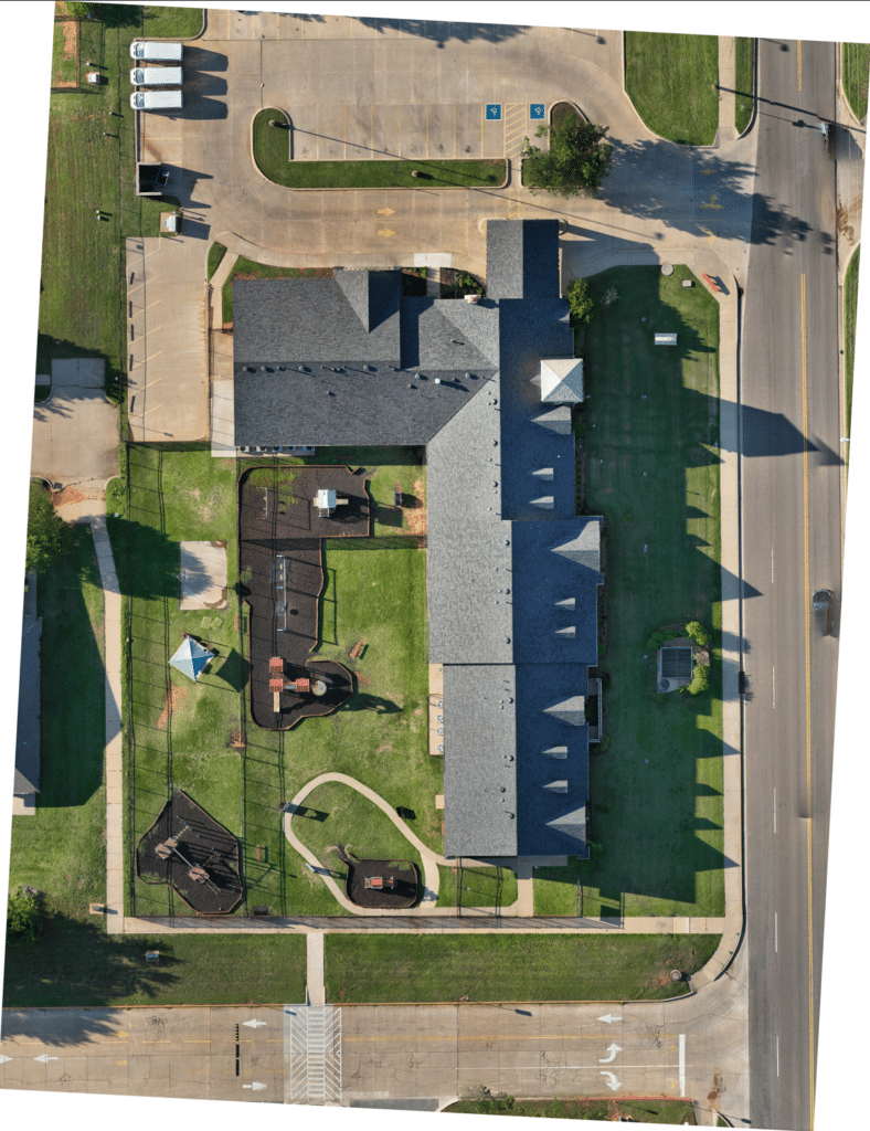
Orthomosaic is a type of mosaic that has been geometrically corrected to minimize distortion and ensure that each pixel represents the same ground area throughout the image. A regular mosaic is a composite image made up of several overlapping images, but it does not have the same geometric correction.
Orthomosaics can be used in construction for tasks such as creating accurate maps, measuring distances and areas, and identifying potential issues with a construction site. They can also be used to monitor progress on a construction site over time.
To ensure that data obtained from aerial lidar and orthomosaics is accurate, it is important to use high-quality sensors and to properly process the data using specialized software. Additionally, ground control points can be used to accurately align the data with known coordinates.
Aerial LiDAR Mapping
A remote sensing technology that uses laser pulses to create high-resolution 3D point clouds of the earth's surface.
Orthomosaic Mapping
The process of stitching multiple aerial images to create a single, geometrically-corrected image.
Precision Drone Photography
The use of UAV technology to capture high-resolution images in challenging or dangerous environments.
