Help Us Find Ferb!

Join our mission to find Ferb the tortoise using cutting-edge drone technology and the strength of our community. See how you can help by reviewing aerial images, learning about our advanced LiDAR and thermal search efforts, and playing a vital role in bringing Ferb home before the cold weather arrives!

Our Mission to Find Ferb

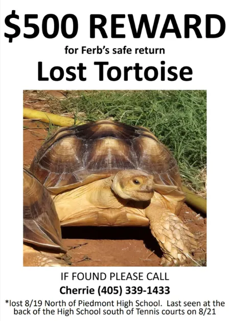
On August 21st, Ferb, a 4-year-old African Sulcata tortoise, went missing near the Piedmont High School tennis courts. Ferb’s owner, Cherrie Zaidi, has been searching tirelessly, but Ferb remains elusive. This beloved pet, about the size of a basketball and weighing 25 pounds, could still be roaming the fields, feeding on Oklahoma’s wildflowers, or hiding in the woods. With the cold of Oklahoma winter fast approaching, time is of the essence to ensure Ferb’s safety.

How We're Using Drone Technology in the Search

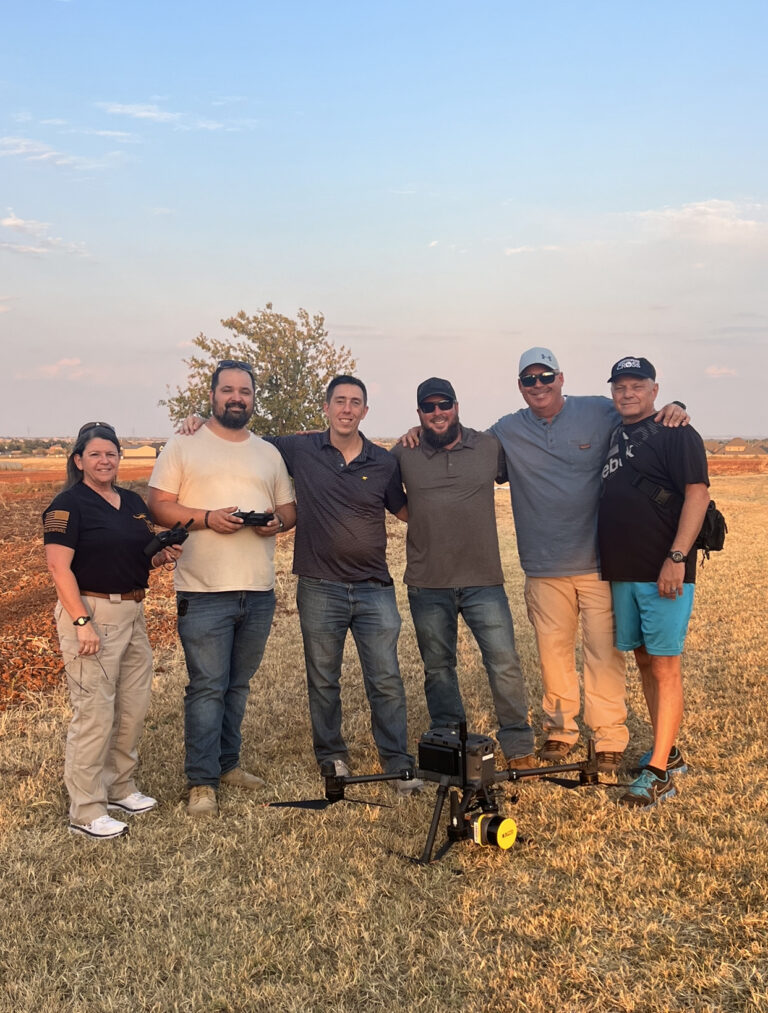
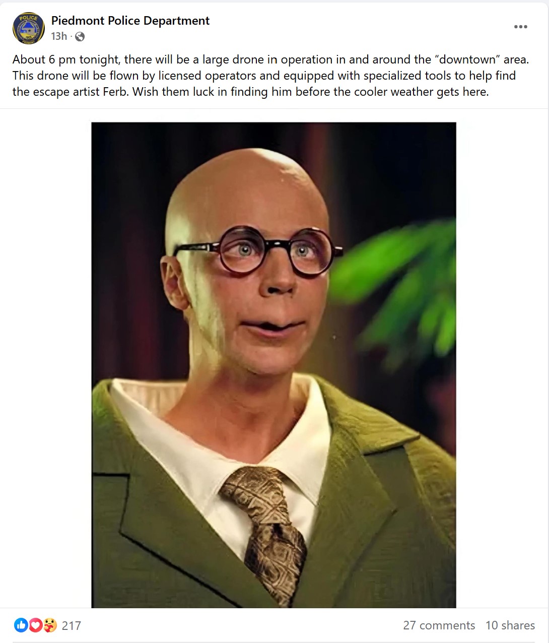
As part of the search, Chris Guarnera, an Adjunct Instructor at Francis Tuttle Technology Center, led students from his LiDAR Mapping course in a mission that has captured the community's attention. Featured on OKC News 9, this innovative project combines advanced drone technology with community service, bringing hope to Cherrie and everyone rooting for Ferb’s safe return. Before conducting the drone search, we coordinated with the Piedmont Police Department, ensuring transparency and safety for the community. The Piedmont PD notified local residents about our drone operations, helping to alleviate concerns about seeing drones in the area and making sure that everyone knew about our efforts to find Ferb. This collaboration with local law enforcement reflects our commitment to a community-driven approach, making sure that all search efforts are safe and respectful of the neighborhood.

Operation Bring Ferb Home

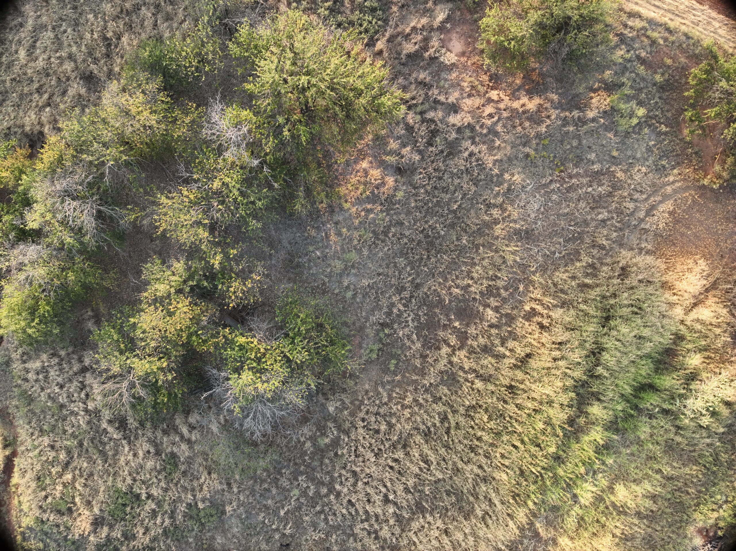
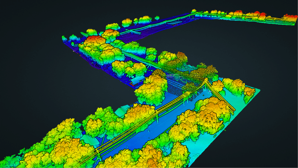
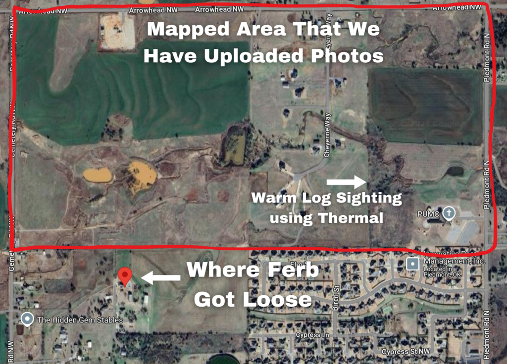
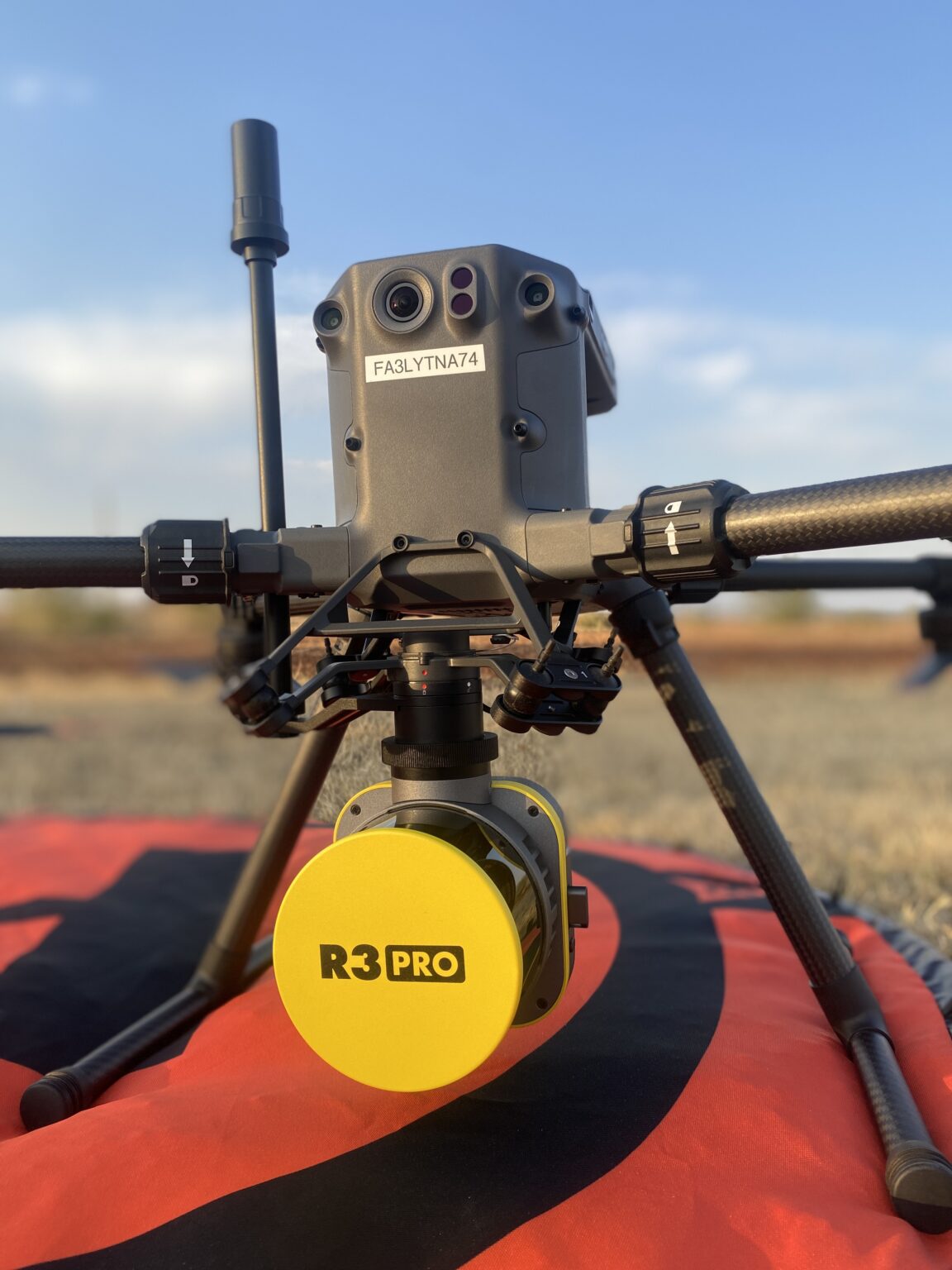
On the evening of October 11th, Chris and his students used a Matrice 350 Drone equipped with a Rock R3Pro LiDAR sensor and an H20T Thermal Sensor to search for Ferb. LiDAR technology allows us to see through dense trees and vegetation, while the thermal sensor helps identify heat signatures on the ground. While the team found several heat signatures—including one that led them through the woods—it turned out to be a warm log with a spider nest. Despite this, the search efforts provided invaluable training for the students and brought the community one step closer to finding Ferb.

Help Us Find Ferb: A Community Effort

Cherrie’s Hope for Ferb

Cherrie, Ferb’s owner, believes that Ferb may be somewhere in the field on the north side of her house. To aid in the search, we mapped a 321-acre area using a Mavic 3 Enterprise drone, capturing high-resolution images from 100 feet above ground level (AGL). We even conducted a test with Ferb’s brother, Phineas, to confirm that Ferb would be visible from this altitude. Based on that test, we’re optimistic that we can spot Ferb among the 1,500 images captured.

Mavic 3 Enterprise Drone Mapping

We’ve mapped the entire 321-acre area, providing a detailed view of the search zone, which includes fields, woods, and potential hiding spots. There’s a great chance that Ferb is hiding somewhere in these photos, and we need your help to find him!

The photos are available now for the community to review. We encourage everyone to join us in this search effort—look through the images, see if you can spot Ferb, and help bring him home.

Click Here to Access the Raw Photos

LiDAR Mapping: Seeing What the Eye Can’t

In addition to the Mavic 3 images, we also deployed a Matrice 350 drone equipped with a Rock R3Pro LiDAR sensor to create a detailed map of the area. LiDAR, which stands for Light Detection and Ranging, is a powerful tool that allows us to see through dense tree canopies and foliage, making it possible to identify hidden objects in places where traditional methods would fail.

This advanced technology is being used in some of the world’s most challenging terrain, such as the dense jungles of Mexico and the Amazon. Archaeologists have used LiDAR to uncover ancient ruins, lost cities, and hidden structures buried under thick vegetation. It has helped reveal the layout of ancient Maya cities in Mexico and locate previously unknown temples and terraces deep within the Amazon rainforest—structures that had been hidden for centuries.

For our search, we are using the same technology in a different way, applying LiDAR’s ability to detect shapes beneath the trees to find Ferb. The detailed scans can reveal hidden features on the ground that might otherwise be missed, like a small tortoise nestled under dense brush or hidden in a grove of trees. With the ability to produce a 3D model of the terrain, we are hopeful that this technology will be a game-changer in locating our lost friend.

The LiDAR data will be ready for review on October 11th, and we’ll update this page as soon as it’s available for the community to explore. This next phase of data provides another opportunity to locate Ferb and bring him home safely, and we are optimistic that with the community’s help, we will succeed.

Elevation Roadway

How You Can Help

Think you see something in the photos? Let us know! Your sharp eyes might be the key to finding Ferb. If you spot anything or have any information, please reach out—every little bit helps!

You can also make a difference by sharing this page with friends, family, and local groups. The more people who join the search, the better our chances of finding Ferb. Let’s rally together and bring Ferb home before winter sets in!

Supporting the Next Generation of Drone Experts

This search effort is part of the LiDAR Mapping course at Francis Tuttle’s Rockwell Campus, led by Chris Guarnera. The 5-week course provides students with hands-on experience using LiDAR-equipped drones to create precise maps, a skill highly valued in the surveying and mapping industries. The collaboration between Francis Tuttle and Chris’s company, Blue Falcon Aerial, has allowed students to work on real-world projects while making a tangible difference in the community.

“The students need places to practice anyways, so we might as well use it to do some good in the world,” says Chris. The project offers a unique opportunity for students to develop their skills and see how their expertise can be applied to meaningful causes.

Homeowner Protection Program

While our focus has been on the search for Ferb, Blue Falcon Aerial is also committed to helping homeowners across Oklahoma. Using advanced drones, Blue Falcon Aerial’s team provides free roof inspections, capturing high-resolution images to document roof conditions. These images can be crucial for homeowners when filing insurance claims after storm damage, ensuring they have the evidence needed to secure fair compensation.

Our program goes a step further by connecting homeowners with a network of rigorously vetted, ethical roofing contractors. Each contractor is carefully screened for licenses, insurance, and reputation, ensuring that homeowners are matched with trustworthy professionals who can address any roof damage found. This service not only offers peace of mind but also guarantees that homeowners receive high-quality care when repairs are needed.

Join the Search and Support Our Efforts

The community’s response has been incredible so far, and with your help, we believe we can bring Ferb home. If you’d like to learn more about the LiDAR Mapping course at Francis Tuttle, Blue Falcon Aerial’s homeowner services, or if you have any information about Ferb, please don’t hesitate to reach out.

For sightings or information about Ferb, please contact: Cherrie Zaidi at 405-339-1433

Together, we can make a difference. Let’s keep the search for Ferb alive and use the power of community, technology, and a little bit of hope to find our lost friend.

Want to Learn More on How we can Help Your Next Project?

Scroll to Top